Tropical Storm Dorian formed this afternoon over the Central Atlantic. Its is a compact storm and has been improving its organization throughout the day. For the last day, the models have been having trouble with the intensity with Dorian with most keeping it as a weak wave, contrary to satellite observations. That is the importance of the National Hurricane Center (NHC) -- human experience, observations, and models. The current forecast will take it through the lesser Antilles towards Puerto Rico and Haiti. It is too early to determine the exact track, but the NHC intensity forecast is calling for a hurricane in 3 days. Many people in Puerto Rico remains vulnerable because of Hurricane Maria 2 years ago. Please stay informed there!!
 |
5 PM Saturday August 24 NHC 5-day track
|
If you live along the path, which includes Barbados, it is not too early to make sure that you are prepared for possible Tropical Storm or Hurricane Watches and Warnings in the coming days. Given the large uncertainty, it is not the time to panic but just plan ahead. As I said in an earlier post, the next few weeks seem favorable for waves from Africa to develop into tropical cyclones.
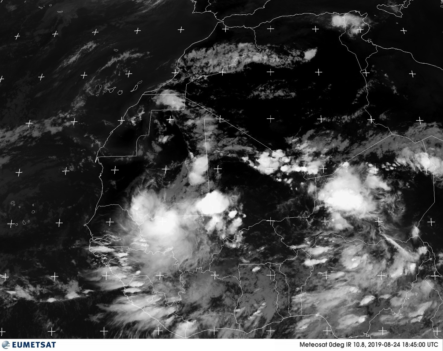
Possible Heavy Rain in Senegal over the next 24 hours
A strong African Easterly Wave (AEW) has dropped heavy rain over Eastern Mali and is moving into Western Senegal. This is a complex weather situation, with the AEW potentially sitting over Senegal in 2 days. Consequently, flooding is a possibility.
 |
| Infrared Image showing deep thunderstorm moving into Western Senegal, at 1845 UTC (2 45 PM EST) on Saturday August 24, 2019. |
I don't have high confidence in the models on this one because (1) There are currently no upper-air observations over to the west of Niger; without actual in situ data, the models are assimilating satellite data. (2) Without these stations, the moisture which triggers thunderstorms is WRONG.
 |
| Upper-Air Observations at 1200 UTC Saturday, August 24, 2019 |
I hope that my friends at the National Weather Service of Senegal (ANICIM) will do their best to watch this situation over the next 48 hours. Near real-time warning systems in West Africa are poorly organized at this point.


No comments:
Post a Comment